

Two Months of Growth and Learning at Definition Surveying
Over the past two months, Steven has embraced exciting opportunities at Definition Surveying, diving into diverse projects and honing his skills under expert mentorship. From extending his Civil 3D knowledge with the Tauranga team, to tackling cadastral surveys and boundary challenges, Steven’s journey has been one of growth and achievement.
His latest blog captures the highlights, including hands-on training, team-building events, and the supportive culture that fuels professional development. It's an inspiring reflection on what makes Definition Surveying a great place to learn, collaborate, and thrive.

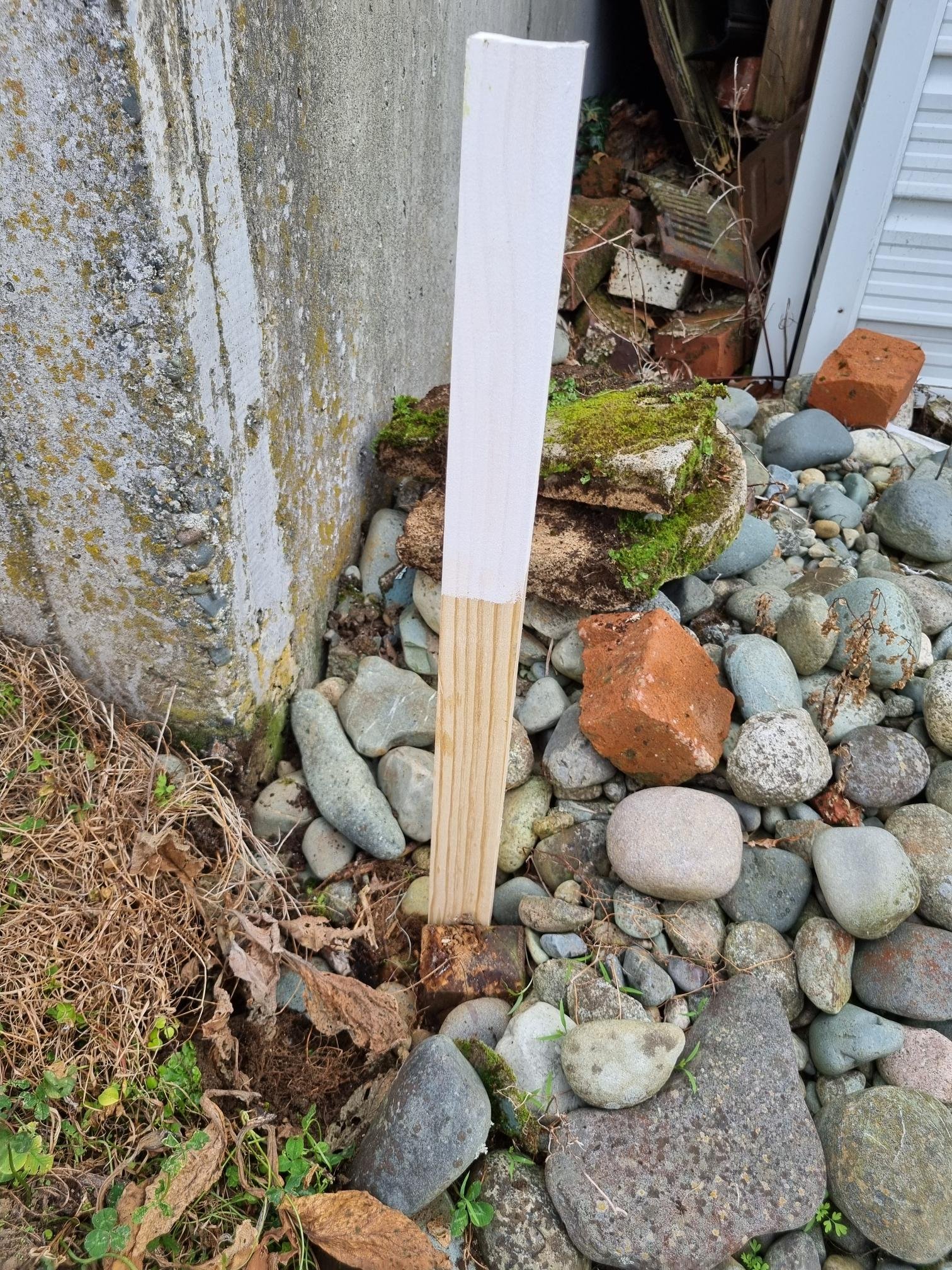
An Urgent Task: Working in the Rain to Help a Client Solve a Pressing Issue
Discover how our surveyor handled an urgent task to help a client move forward with their building project. The client needed a certified floor level reference to install a prefabricated house, and despite heavy rain and tight deadlines, our surveyor completed the job with precision using advanced tools. Along the way, they also assisted a neighbour by correcting boundary peg placement, showing the importance of professional surveying. The client was thankful for the fast and reliable service, demonstrating the value of accurate and timely surveying solutions.

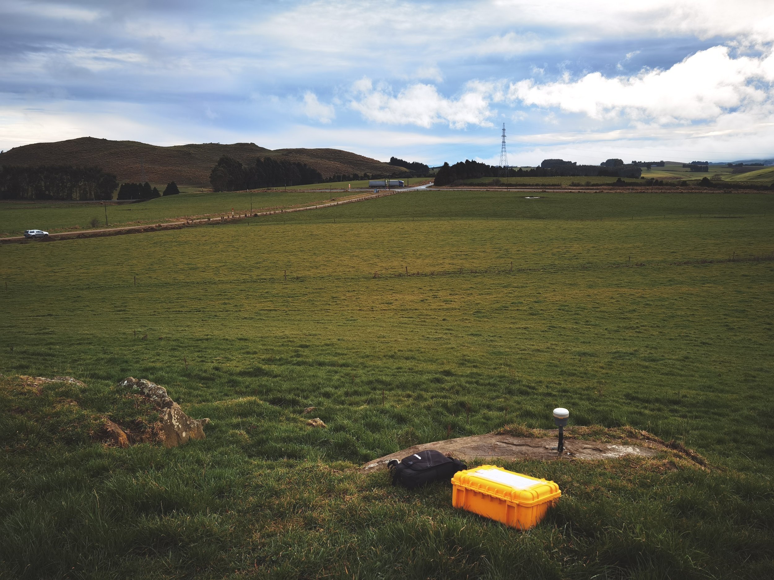
Unlocking Precision: The Benefits of High-Resolution Aerial Drone Surveys
Technological advancements are reshaping how we handle important practices, such as surveying land.

Surveyors Certificate’s or Building Location Certificate’s

Understanding Survey Marks: A Key to Accurate Mapping and Development.
Survey marks are essential for accurate mapping, property boundary definition, and infrastructure development in New Zealand. Managed by Land Information New Zealand (LINZ), these markers provide crucial data for urban planning, natural disaster management, and historical preservation. With New Zealand's unique topography and tectonic activity, survey marks ensure precise location tracking and support a wide range of applications, from real estate to environmental conservation. Discover why these seemingly simple markers are vital for New Zealand’s land management and development.

Reflections on Independently Completing a Topographic Survey
Steven reflections on completing his first independent topographic survey for a residential land subdivision. He will share how his skills have improved since his first survey, the challenges he encountered, and how he tackled them. He will also discuss key insights he has gained from other tasks, such as measuring sewage pipeline heights, and the importance of mastering proper techniques and tools for fieldwork efficiency and safety.

Reflections and Insights from My Third Month
This blog will reflect on experiences during 3D laser scanning sharing key insights, from navigating complex equipment layouts to understanding the crucial role of hygiene in food factory environments. Steven will also dive into the challenges of managing large data sets, the importance of precision, and how these experiences have shaped his professional skills and attitude.

The Essential Role of Professional Residential Land Surveyors: What Homeowners Need to Know
It’s essential for New Zealand homeowners to understand the importance of professional residential land surveyors and their services.
What is the difference between a Boundary Identification & a Boundary Reinstatement?
In New Zealand, understanding the distinction between a Boundary Identification and a Boundary Reinstatement is crucial for managing property boundaries. We’ll dive into their meanings, highlighting their differences, processes, and impacts to help you navigate property boundary issues effectively.
The second month's learning and practical journey: Initial experience of Topographic (Topo) Surveying
Through hands on experience, Steven explains the basics of completing a Topographic Surveying and what he learn’t through the process. Read on to find out more…

Journey of a Survey Technician…

Revolutionising Surveying with 3D Services: Accuracy and Insights
Among the most notable developments is the rise of comprehensive 3D services, which have completely revolutionised surveying.

Aerial Surveying Revealed: Applications and Advancements
Aerial surveying involves capturing detailed information about a plot of land from an elevated height, usually by utilising drones and scanners.

Beyond the Surface: Enhancing Data Accuracy with 3D Surveying
As the years pass and we hone the ways we survey land, newer and better technology emerges to revolutionise how we capture crucial data.

Aerial Drone Surveys: Transforming Data Collection From Above
As we look to the future, the role of drone surveys in transforming data collection from above cannot be overstated.

Elevating Precision: The Future Of Land Surveying With Drones
In the ever-evolving landscape of land surveying, the integration of cutting-edge technology has become a game-changer.
Control Survey In Civil Engineering
A control survey in civil engineering refers to the establishment of precise and known reference points on the Earth's surface.

The Third Dimension Unveiled: Navigating 3D Surveying Services
In the ever-evolving landscape of surveying technology, the integration of three-dimensional, or 3D, surveying services has emerged as a transformative force.

Hastings Surveyors: Your Local Experts for Land and Property Services
When it comes to land and property, the foundation for informed decision-making and successful development lies in accurate and reliable surveying services.