Our Clients
-
![]()
Aecom
-
![]()
Align
-
![]()
Bluehaven Group
-
![]()
DOC
-
![]()
Fonterra
-
![]()
GHD
-
![]()
HCC
-
![]()
Kaitiaki Property
-
![]()
Kainga Ora
-
![]()
LDE
-
![]()
LINZ
-
![]()
NCC
-
![]()
NZTA
-
![]()
Stantec
-
![]()
TCC
-
![]()
TPG
-
![]()
Tonkin + Taylor
-
![]()
TW Property
-
![]()
Unison
-
![]()
WBoPDC


Our Services
-
Land Transfer Subdivision
The subdivision process can be complex, lengthy, and highly regulated. It takes specialist knowledge, resources and plenty of time. We’re here to guide you and manage the process for you to ensure all regulatory obligations are met with your council as quickly as possible. Whether you’re rural or urban, we’re ready and waiting to help you make the most of your land.
-
Boundary Redefinition / Identification Surveys
Property boundaries are sometimes hard to find, if you and your neighbour are looking to erect a fence, build a shed or perhaps invest in an extension to the family home, let us know, it’s always nice to know that you are building in the right place.
-
Topographical Surveying / Detail Surveys
Sometimes called a site survey, a topographic survey documents the topographical features and contours of your property. Our experienced surveyors will record features necessary for the development of your site.
-
Civil Engineering and Planning
Definition Surveying partners with Civil Engineers, Planners, Geotech Engineers and Contaminated Land experts, assembling comprehensive teams to cater to the needs of your projects. Definition Surveyors have experience throughout the entire development process and are well placed to take the lead where required. Talk to us today about how we can help manage your project.
-
Construction Set Out
With projects that require precise set-out, it’s imperative to have a reliable, experienced team providing you with an accurate set-out information you can rely on. At Definition Surveying we utilise state of the art technology, paired with a clear understanding of the project requirements to ensure that your project gets off to a good start.
-
Whenua Māori
Whether you require a scheme plan to support a License to Occupy with an administering Land Trust or you need to have a plan prepared for an Occupation Order for the Māori Land Court, the team at Definition Surveying are here to assist. We have experience dealing with Hapū Partitions, Full Partitions and working with whānau to develop their Papakāinga aspirations.
-
Monitoring
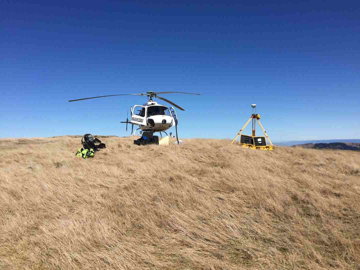
As regulations tighten, there’s an increase in need for monitoring surveys. Our team can customise a monitoring method to the project and site at hand. We offer a variety of methods and equipment to capture all necessary data with an extraordinary level of accuracy. With our tailored approach, we ensure that the monitoring solutions we provide are both low cost, and fit-for purpose.
-
3D Capture
From terrestrial laser scanning to mobile laser scanning or Aerial LiDAR we can assist with procuring the appropriate solution. We utilize scanners and drones to capture 3D data. Whatever your project requires our Surveyors at Definition Surveying have the knowledge and experience to deliver.
-
Hawke’s Bay Interim Titles
Definition Surveying has experience dealing with titles that are limited as to parcels, and the deficiencies that are associated with Hawkes Bay interim titles.
The term ‘interim title’ is a record of title issued under the Land Transfer (Hawke’s Bay) Act 1931 that, as a consequence of the 1931 Hawke’s Bay earthquake, is not conclusive as to the area or boundaries of the land contained within it. If you would like to know more, Land Information New Zealand has some great content.
-
Height in Relation to Boundary Surveys
Are you planning on building close to your legal boundary? Many councils require a certificate certifying you meet conditions setting how close you are to the boundary. Feel free to reach out and discuss this with one of our Licensed Cadastral Surveyors.
-
Council Infrastructure Projects
We provide cost effective, reliable support to councils and consultants. From topographical surveys of wetlands, rivers, and coastlines to roading, reserves and other infrastructure. Our competitive pricing, commitment to health and safety, and reliable advice make us the preferred partner for many councils throughout New Zealand.
-
Legalisation Surveys
Legalisations are surveys undertaken to support public works and are typically associated with public infrastructure like roads and bridges. Parcels of land are created to support the acquisition or setting apart of land for public works or other public purposes under particular legislation. We have completed multiple legalisation surveys and have expert Licensed Cadastral Surveyors that can undertake this work.